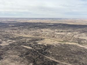
Snowpack deficit , drought impacts Wyoming
The all-important winter snowpack, which sets the stage for a foundation of moisture, has been hit or miss in the western U.S., despite the ongoing El Nino climate driver triggering several rounds of Pacific storms careening across the West. Although 3 feet of snow blanketed the northern Arizona mountains, and a foot of snow fell recently in the mountains of Colorado and New Mexico, the northwest U.S., specifically Wyoming is struggling with a lack of snowpack, which was detailed during the Intermountain West Drought and Climate Outlook webinar Tuesday, Feb. 20, 2024.
This month’s webinar highlighted tools and resources to better understand drought in Wyoming, as well as climatic events like El Niño and La Niña.
WYOMING DROUGHT
The webinar largely focused on Wyoming. Basin snowpack is still below-normal with some of the worst conditions reported in the northern Rocky Mountains.
As of Feb. 20, the drought had expanded across the northern tier of Wyoming, as well as west, central, and eastern Wyoming unfortunately. The exception is a section of west central Wyoming which is doing better with snowpack.
“The northern reaches are not doing as well and the eastern basins could be a lot better. The South Platte looks horrible, and somewhat is, but that is based on a single station (Crow Creek) just east of Laramie,” said Tony Bergantino, director, Wyoming State Climate Office – Water Resources Data System at the University of Wyoming, and director of the Wyoming Mesonet. Bergantino was a speaker on the webinar.
NORTHERN VS SOUTHERN
A big concern is the Bighorns. “The Powder River Basin snowpack is under the minimum which means it is at the lowest in over 40 years,” Bergantino said, adding, “Even if they begin receiving ‘normal’ daily increases in snowpack now through the end of the season, they would still be around the minimum.”
There is a lot less snow this year than last year. “It’s striking how different it was two years ago,” said Tony Anderson, senior service hydrologist at the National Weather Service in Cheyenne, Wyo., and another speaker on the webinar. “But, the good news is a lot of these basins have slightly improved from two weeks ago, although admittedly, they were doing better last year,” he added.
Wyoming’s best snowpack is in west central (Wind Basin) and also in the southwest/south central sections of Wyoming. Snow has been increasing in the southwest part of Wyoming, along with some of the western-central areas, Bergantino said. The Wind Basin has been seeing positive changes and is within a few percentage points (above or below) the median.
“It’s stable this week in the south (week of Feb. 19) however in the north, the Big Horns have no snow below 8,000 feet, which is pretty much ridiculous this time of year,” Anderson said.
According to the Drought Monitor, the round of Pacific storms arriving just before Valentine’s Day helped the southwest U.S. finally return to near-normal conditions, after getting off to a crawl at the start of the new year. The vast improvement there has helped both short term and long term drought conditions in the southwestern states.
Rest of the West:
Arizona: 54.6% in drought.
Colorado: 11.7% in drought.
New Mexico: 88.2% in drought.
Utah: 3.8 % is in drought
Wyoming: 21.7% is in drought.
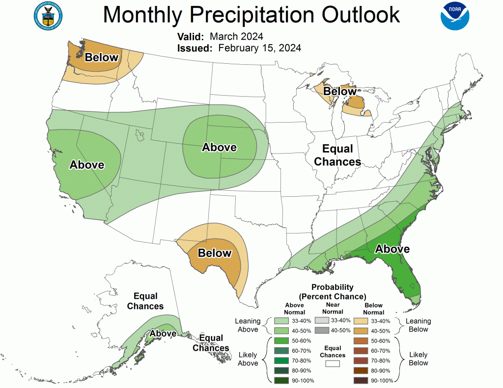
In Colorado and Utah, there’s near average precipitation. New Mexico and Arizona are just below average.
Meanwhile precipitation in Wyoming is well below normal.
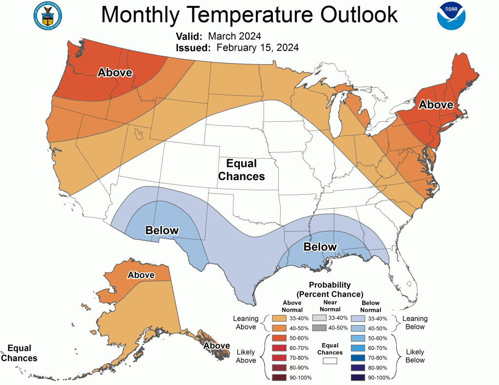
“Generally speaking, it has been a relatively warm and dry winter in the west,” Anderson said. Over the last two weeks there have been large changes in Wyoming’s precipitation, Anderson said. There are areas with above-normal precipitation, although Wyoming isn’t doing well.
Snowpack acts as a natural reservoir, and supplies the all-important water during the typically drier summer months. Lack of snowpack is a challenge for planning around drought conditions. The term snow drought means a period of unusually below normal snowpack. According to recent research, the western U.S. is now considered a global snow drought hot-spot.
WATER AND CLIMATE EXPLORER
Also on the webinar, the Water and Climate Explorer was introduced, after recently being improved, as a tool for the public to see conditions in Wyoming such as Snow Water Equivalent by overlaying different maps. People can examine the percent of average precipitation for multiple periods of time and overlay the snow water equivalent or drought monitor right on top of it on a computer screen or mobile device.
“You can also see where soils are dry that are still not getting precipitation,” Bergantino said. It also offers the ability to choose any National Weather Service station in the country and retrieve its data to find the latest temperature, wind speed, direction, possible temperature inversions in effect, determine frost depth, how much precipitation has fallen and more.
The link to the Explorer: https://www.wrds.uwyo.edu/wace/wacehome.html
DROUGHT OUTLOOK
The drought outlook calls for drought to persist but not worsen across the Intermountain West, Anderson said. Little or no removal of drought is anticipated through May. No drought intensification is expected either.
A transition from El Niño to ENSO-neutral is likely by April-June 2024 (79% chance), with the expectation of transitioning to La Niña (the opposite climate phenomenon) in June-August 2024 (55% chance).
“El Nino years tend to bring late winter and early spring snow accumulation to Colorado and Wyoming. We have seen this strongly exhibited in years with rapid transitions from El Nino to La Nina, which is similarly forecast for this year,” Anderson explained. “So there is reason to hope that we could see significant late season accumulation of snow this year.”
The water level at both Lake Powell and Lake Mead remains extremely low. Lake Powell shows a decline that’s expected to continue over the next two years, although not terribly so, Anderson said. What happens in Lake Powell directly affects Lake Mead, he noted.
This webinar was hosted by National Oceanic and Atmospheric Administration’s National Integrated Drought Information System. NIDIS is a partnership that coordinates drought monitoring, forecasting, planning, and information at national, tribal, state and local levels.