Lingering La Niña means generally warmer-drier weather and storms in mid-spring
With ground temperatures well above normal in the Central Plains, the spring growing season may be off to an early start for many farmers. As the region transitions from one of the warmest winters on record, the spring outlook released from the Climate Prediction Center, Thursday, Feb. 19, 2026, for the Central Plains and the Central Rockies indicates a continued trend of warmer than normal temperatures and a slightly increased likelihood of near or slightly below-normal precipitation.
NEBRASKA AND KANSAS
Overall, average temperatures across the entire region of Nebraska and Kansas are projected to remain at or above normal from March through May.
“Despite the transition away from La Niña, long-term dryness is projected to continue across much of Nebraska, though we anticipate a gradual improvement in precipitation chances during the April and May planting season. While much of Kansas remains drought-free due to timely fall and winter precipitation, the Sunflower State is still expected to experience slightly drier than normal conditions in the early spring,” said Michael Moritz, warning coordination meteorologist, National Weather Service in Hastings, Neb.
The story for spring in Kansas is also concerning, said a Kansas climatologist.
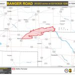
“With extremely heavy fuel/grass/biomass loading from last year’s good growing season, the landscape is primed with copious above-normal vegetation to fuel wildfire. Unfortunately, we already saw this culminate with several large fires in western Kansas. This is early in the season, with the typical fire season peaking in March and April,” said Christopher “Chip” Redmond, Kansas State University meteorologist and Kansas Mesonet manager.
The forecast suggests this active weather pattern will likely continue into March. With the Climate Prediction Center forecasting below-normal precipitation and above-normal temperatures favored for western Kansas, this could lead to several wind events associated with dry frontal passages, Redmond said, noting this would align with a typical La Niña like late winter conditions, when we typically see dry/warm southwest U.S. conditions advect northeast into the High Plains. The CPC suggests western Kansas will see drought expansion into early spring as a result.
“La Niña is forecast to dissipate and transition to at the least, neutral, with some models predicting El Nino by summer. This pattern historically shifts towards more storms, and these patterns typically result in an increase of severe weather in Kansas, including tornado outbreaks in April,” Redmond said. Timely moisture is expected as a result. However, wetting moisture may be limited in coverage, and isolated dry areas are still possible into summer.
COLORADO
Colorado needs snowpack and persistent colder temperatures, but the latest CPC spring outlook for Colorado is indicating warm and dry conditions favored through May.
“While the Plains saw above normal precipitation for the month of January, this can be a bit deceiving. January average precipitation across eastern Colorado is on the drier side (most sites in the 0.25 inch to 0.35 inch range), and it can take a storm like the Valentine’s Day system, to bring us above-normal precipitation,” said Kyle Mozley, meteorologist, National Weather Service in Pueblo, Colo.
Various climate teleconnections, which are patterns that span thousands of miles, are pretty much non-factors at this point.
“Given the lack of teleconnection signals, we will most likely have to rely on the MJO (Madden-Julian Oscillation) with its eastward-moving tropical deep convection and ENSO (El Nino-Southern Oscillation) signals this spring. The MJO is forecast to be active through March, and although the first half of March looks dry, the MJO’s later stages should bring an active period of weather for a few days (March 14-22 time frame), Mozley said.
“Looking at the longer ranges, an active period from the end of April into early May also may be possible,” he added.
“Overall, I agree with the CPC outlook of warm and dry this spring, with an active period in mid-March, and possibly late April, where we may see an uptick in precipitation,” Mozley concluded.
El Nino for Colorado could mean possibly more precipitation, but El Nino isn’t expected until closer to October or November.

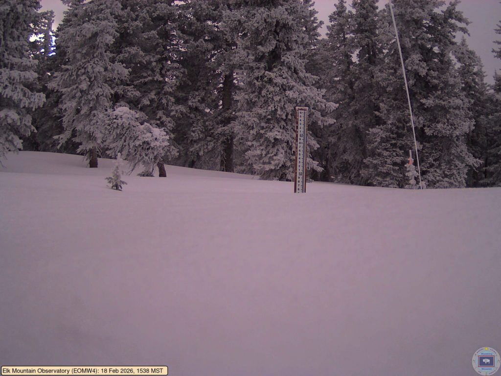
WYOMING
Wyoming, unfortunately is expecting continued above-normal temperatures in March, with the highest chances in the southern part of the state. Regarding March precipitation, most of Wyoming has equal chances of having either above, below or normal precipitation. “Southeast Wyoming is leaning toward below normal. That, coupled with the temperature outlook, is not good for snowpack, which is already far below normal,” said Tony Bergantino, director of the Wyoming State Climate Office and Wyoming Mesonet director.
“Jumping to the three-month outlook for March, April and May, the first half to two-thirds of which are snowpack-building months, we are again looking at above-normal temperatures, especially in the southwest but continuing to the northeast… cutting a rough northwest-southeast diagonal across the state,” Bergantino said. Spring precipitation for the southern half of Wyoming leans below normal, which, again, is not good news for water supply.
“None of these signals are overly strong, so they could be thought of as a slight to moderate lean for above-normal temperature and below-normal precipitation in those areas that are showing, other than a “three-way tie” for above/normal/below conditions,” Bergantino noted.